.webp)
.webp)
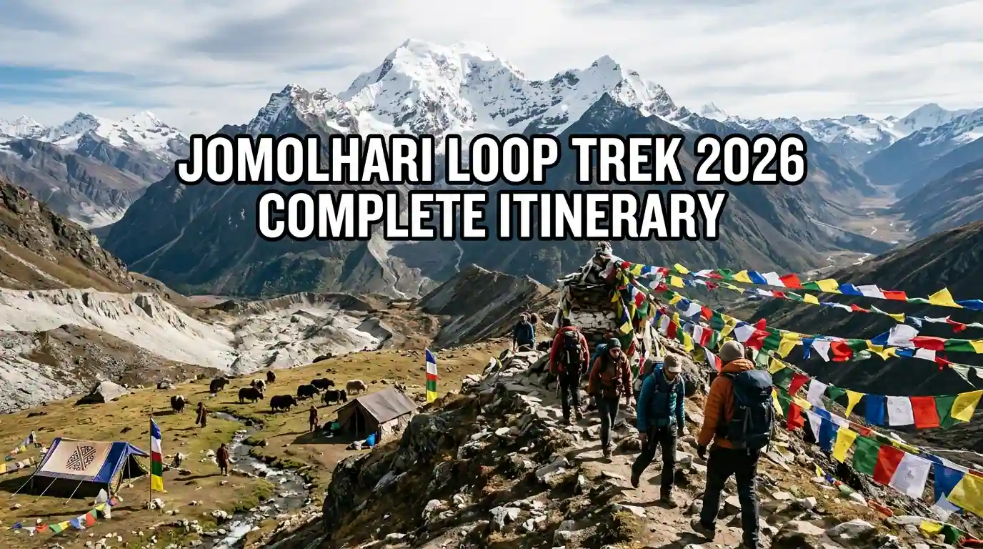
Discovering the Sacred Jomolhari Loop Trek
The Jomolhari Loop trek stands as one of Bhutan's most spectacular and spiritually significant high-altitude journeys, circling the base of Mount Jomolhari (seven thousand three hundred fourteen meters), revered as the abode of the protective deity Jomo Miyalangma. This challenging six to seven-day trek takes adventurers through dramatic Himalayan landscapes, remote yak herding camps, ancient monasteries, and across high mountain passes exceeding four thousand nine hundred meters elevation.
Unlike many commercialized treks in other Himalayan regions, the Jomolhari Loop maintains an authentic wilderness character with minimal infrastructure, requiring self-sufficient camping and offering genuine encounters with Bhutan's traditional pastoral culture. The trek's difficulty level classifies as strenuous due to high altitudes, long hiking days, and significant elevation gains, making it suitable only for experienced trekkers with good physical conditioning.
The route traverses diverse ecosystems from temperate oak and rhododendron forests through alpine meadows to barren glacial moraines, providing exceptional biodiversity viewing opportunities including chances to spot rare species like snow leopards, red pandas, and Himalayan tahrs. Cultural highlights include visits to Jomolhari Lhakhang temple at the mountain's base and interactions with semi-nomadic yak herders who maintain centuries-old traditions.
Bhutan's sustainable tourism policy requires all trekkers to use licensed guides and pay daily Sustainable Development Fees, ensuring that trekking benefits local communities while minimizing environmental impact. The 2026 trekking season brings updated permit procedures and enhanced safety protocols that all visitors must understand before embarking on this remarkable journey.
Trek Overview and Key Statistics

Understanding the trek's scope and requirements helps trekkers prepare adequately and set realistic expectations for this demanding high-altitude adventure.
Trek Duration and Distance
The complete Jomolhari Loop typically requires six to seven days of actual trekking, not including arrival and departure days in Paro. The standard itinerary covers approximately ninety to one hundred kilometers of hiking depending on the specific route variation chosen.
Daily hiking distances range from twelve to twenty kilometers with six to eight hours of walking time on most days. The longest and most challenging days involve crossing high passes which require early starts and can extend to nine or ten hours of trekking.
The loop format begins and ends at different trailheads requiring vehicle transfers, or can be completed as an out-and-back route from the same starting point. Most trekkers opt for the loop to experience varied scenery and avoid retracing steps.
Altitude Profile and Acclimatization
The trek reaches maximum elevation at Jomolhari Lhakhang pass at four thousand nine hundred meters with several other passes exceeding four thousand five hundred meters. Starting elevation in Paro sits at twenty-two hundred meters, providing gradual ascent but requiring careful acclimatization.
The altitude gain profile follows a climb-high sleep-low principle on most days, ascending to high passes during daytime then descending to lower camps for overnight stays. This pattern aids acclimatization though the overall elevation gain remains significant.
Acclimatization days are built into standard itineraries typically at Jomolhari base camp around three thousand eight hundred meters before attempting the highest passes. These rest days prove crucial for preventing altitude sickness and ensuring trek completion.
Rapid ascent rates on certain sections increase altitude sickness risk making awareness of symptoms and having descent plans essential for safety. The remote nature of the trek means evacuation requires helicopter rescue in serious cases.
Difficulty Assessment
The Jomolhari Loop ranks as strenuous to very strenuous on the difficulty scale requiring excellent physical fitness, prior high-altitude trekking experience, and mental preparation for challenging conditions. This is not a trek for beginners.
Technical difficulty remains moderate with no climbing equipment required, but the combination of altitude, distance, and elevation gain creates substantial physical demands. Trekkers must be comfortable with long days on rough mountain trails.
Weather variability adds to the challenge with potential for snow, rain, high winds, and extreme temperature swings even during peak trekking seasons. Flexibility and proper gear prove essential for handling changing conditions.
The remote wilderness setting means limited rescue options and self-reliance requirements increase compared to more developed trekking regions. Trekkers must accept these inherent risks when committing to the journey.
Best Time to Trek Jomolhari

Seasonal timing significantly impacts trekking conditions, scenery, and overall experience quality on the Jomolhari Loop.
Spring Season March to May
Spring represents the most popular trekking season for Jomolhari with stable weather, blooming rhododendrons, and clear mountain views. April and May offer optimal conditions though March can still be quite cold at higher elevations.
Temperatures range from minus five to fifteen degrees Celsius at higher camps with warmer conditions at lower elevations. Nighttime freezing remains common throughout the spring season requiring appropriate sleeping bags.
Rhododendron forests burst into spectacular bloom during late April and May creating stunning scenery with red, pink, and white flowers contrasting against snow-capped peaks. This natural display ranks among Bhutan's greatest natural attractions.
Spring trekking avoids the monsoon rains and winter snow though late spring can see afternoon cloud buildup. Morning starts maximize clear weather windows for pass crossings and photography.
Autumn Season September to November
Autumn provides equally excellent trekking conditions with stable weather, clear skies, and comfortable temperatures making it the second peak season alongside spring.
September offers warm temperatures though monsoon remnants can bring occasional rain early in the month. October and November provide the most stable weather with minimal precipitation and excellent visibility.
Fall foliage adds color to the landscape with golden larch trees and changing leaf colors in lower valleys complementing the white peaks and blue skies. Photography conditions prove exceptional during autumn.
Crowds increase during October particularly around Bhutan's major festivals though the Jomolhari trek's difficulty limits numbers compared to easier routes. Booking guides and permits well in advance remains advisable.
Winter and Monsoon Considerations
Winter trekking from December through February proves extremely challenging with heavy snow, sub-zero temperatures, and potential pass closures. Only experienced winter mountaineers should attempt Jomolhari during these months.
Monsoon season from June through August brings heavy rainfall, leeches, landslides, and obscured mountain views making trekking unpleasant and potentially dangerous. Most operators do not offer Jomolhari treks during monsoon.
Shoulder seasons in late May and late November can provide good conditions with fewer trekkers though weather becomes less predictable. These periods suit those prioritizing solitude over guaranteed perfect weather.
Climate change impacts are altering traditional weather patterns making conditions less predictable than historical norms. Flexibility in itinerary and extra buffer days prove wise regardless of season chosen.
Permits and Regulations for 2026

Bhutan's regulated tourism system requires specific permits and adherence to policies that all Jomolhari trekkers must understand and comply with.
Sustainable Development Fee
All tourists must pay the Sustainable Development Fee of one hundred USD per person per day as of 2026 regulations. This fee funds Bhutan's free healthcare, education, and infrastructure development programs.
The SDF applies to all days spent in Bhutan including trekking days and must be paid in advance or upon arrival. Children under twelve years pay reduced fees while infants under five enter free.
Indian nationals pay a different fee structure of one thousand two hundred Ngultrum per day though must still obtain permits and use licensed guides for trekking in restricted areas like Jomolhari.
The SDF represents a significant cost factor in budget planning though ensures that tourism directly benefits Bhutanese society and maintains the country's unique development philosophy.
Trekking Permits Required
Special Area Permit is mandatory for the Jomolhari region as it lies in a restricted border zone near Tibet. This permit requires additional processing time beyond standard tourist visas.
Trekking permits specify exact routes, dates, and group composition and must be carried at all times during the trek. Checkpoints along the route verify permits so losing them creates serious problems.
Permit applications require passport copies, itinerary details, guide information, and emergency contact details. Licensed tour operators handle this paperwork though trekkers must provide accurate information promptly.
Permit processing takes five to seven business days minimum so last-minute bookings prove impossible. Plan well in advance particularly for peak season treks when permit quotas may fill.
Guide and Porter Requirements
Bhutan law mandates that all trekkers use licensed Bhutanese guides for the Jomolhari route. Independent trekking without guides is not permitted in this restricted area.
Guides must be certified by the Tourism Council of Bhutan with specific high-altitude trekking training and first aid certification. Verify your guide's credentials before committing to a tour operator.
Porter or pack animal support is strongly recommended though not legally required. The heavy loads needed for high-altitude camping make carrying everything yourself impractical and unsafe.
Guide and porter costs are separate from the SDF and typically range from twenty-five to forty USD per day for guides and fifteen to twenty-five USD for porters depending on experience and season.
Detailed Day by Day Itinerary

This comprehensive itinerary provides realistic daily expectations for completing the Jomolhari Loop safely and enjoyably.
Day One Paro to Shana
Trek begins with drive from Paro to Drugyel Dzong then hike to Shana camp at two thousand eight hundred meters. The drive takes one hour followed by four to five hours of trekking through mixed forest.
The trail follows the Pa Chu river valley with gradual elevation gain through beautiful oak and rhododendron forest. Wildlife spotting opportunities include deer, monkeys, and diverse bird species.
Shana offers basic camping sites near the river with water access and relatively flat ground. This first day serves as acclimatization with moderate distance allowing bodies to begin adjusting to altitude.
Evening temperatures remain mild though rain protection proves necessary. Guides prepare hot meals and tea while trekkers rest and prepare for more challenging days ahead.
Day Two Shana to Jangothang
Second day involves six to seven hours trekking to Jangothang at three thousand eight hundred meters, the base camp beneath Mount Jomolhari. This represents a significant altitude gain requiring steady pacing.
The trail climbs through increasingly sparse forest transitioning to alpine meadows with spectacular mountain views emerging. Rhododendron gives way to juniper and eventually bare rock and grass.
Jangothang provides one of the trek's most dramatic settings with Jomolhari's massive north face dominating the skyline. The wide valley hosts yak herding camps during summer months offering cultural interactions.
This camp serves as acclimatization point with many itineraries including a rest day here before attempting high passes. Exploring the base of Jomolhari and visiting Jomolhari Lhakhang temple fills rest day productively.
Day Three Jangothang Acclimatization
Rest day at Jangothang proves crucial for acclimatization before tackling the trek's highest passes. Light activity like short hikes to higher elevation then returning to sleep low aids acclimatization.
Morning can include visit to Jomolhari Lhakhang, a small temple at the mountain's base considered extremely sacred. Photography inside the temple is prohibited and respectful behavior essential.
Afternoon rest allows bodies to adjust to altitude while guides check weather conditions and plan the next day's early start. Hydration and nutrition receive emphasis during rest days.
Clear weather on rest days provides opportunity for photography and simply absorbing the spectacular mountain scenery. Many trekkers consider Jangothang the trek's highlight for its dramatic setting.
Day Four Jangothang to Lingshi
Crossing Nyile La pass at four thousand eight hundred meters makes this the trek's most challenging day requiring eight to nine hours of strenuous hiking. Early four AM start proves essential for safe pass crossing.
The climb to the pass involves steady ascent over rocky moraine with decreasing oxygen levels creating breathing difficulty. Pacing becomes critical with frequent rest stops necessary even for fit trekkers.
Pass crossing rewards with panoramic views of Jomolhari, Jichu Drake, and Tsherim Kang peaks on clear days. Prayer flags mark the summit where trekkers traditionally leave offerings and take photographs.
Long descent to Lingshi at four thousand fifty meters tests knees and requires careful footing on loose scree. Lingshi features a historic dzong and small village providing cultural interest after the physical challenge.
Day Five Lingshi to Laya
Day five involves crossing Gophu La pass at four thousand six hundred fifty meters then descending to Laya village at three thousand eight hundred forty meters. Total trekking time reaches seven to eight hours.
The route traverses high alpine terrain with potential snow patches even in good seasons. Views remain spectacular though the landscape becomes more barren at these elevations.
Laya village provides fascinating cultural experience as home to the semi-nomadic Layap people with distinctive dress and customs. The village's remote location has preserved traditional lifestyles largely unchanged for centuries.
Layap women wear distinctive conical bamboo hats and heavy woolen clothing while men carry traditional swords. Photography requires permission though most villagers welcome respectful visitors.
Day Six Laya to Rodophu or Tshojo
Descent continues through increasingly forested terrain to Rodophu at three thousand six hundred meters or further to Tshojo at three thousand three hundred meters. This six to seven hour day provides relief from high altitude.
The trail drops through alpine meadows then enters rhododendron and fir forest with elevation loss making hiking feel easier. River valleys become more prominent as the route descends.
Campsites offer more shelter and warmer temperatures than previous high camps. This proves a welcome change after several nights in exposed, cold high-altitude locations.
Forest returns bring bird song and increased wildlife activity. Trekkers often spot monal pheasants, blood pheasants, and other Himalayan bird species during this section.
Day Seven Rodophu/Tshojo to Dhumzo then Paro
Final trekking day descends to Dhumzo at two thousand eight hundred meters then drives back to Paro completing the loop. Total journey takes five to six hours trekking plus two hours driving.
The morning descent passes through beautiful forest with suspension bridge crossings adding interest. Gradual elevation loss makes for comfortable hiking as the trek concludes.
Dhumzo village provides last camping opportunity before returning to civilization. Hot showers and comfortable beds in Paro await after the final drive making this a satisfying conclusion.
Celebration dinner in Paro allows trekkers to reflect on the journey while enjoying Bhutanese cuisine. Many trekkers extend stays in Paro to visit Tiger's Nest monastery after completing the trek.
Essential Gear and Packing List

Proper equipment proves critical for safety and comfort on this demanding high-altitude trek where weather can change rapidly and rescue options remain limited.
Clothing System
Layering system proves essential for managing variable conditions with moisture-wicking base layers, insulating mid-layers, and waterproof windproof outer shells. Avoid cotton entirely as it retains moisture and causes hypothermia risk.
Down or synthetic insulated jacket rated for minus fifteen to minus twenty degrees Celsius provides essential warmth at high camps. This jacket proves crucial during cold mornings and evenings at altitude.
Trekking pants should be quick-drying and durable with convertible options useful for temperature variations. Bring thermal leggings for wearing under pants at high camps and during pass crossings.
Waterproof hardshell jacket and pants protect against rain, snow, and wind. Quality matters here as cheap rain gear fails in serious conditions potentially creating dangerous situations.
Footwear and Accessories
Well-broken-in waterproof trekking boots with ankle support prove non-negotiable for this rugged terrain. Boots should have aggressive tread for traction on loose scree and potential snow.
Bring camp shoes or sandals for rest periods to give feet a break from heavy boots. Lightweight down booties provide warmth at camp and make cold mornings more bearable.
Warm hat, sun hat, buff or balaclava, and gloves ranging from lightweight to heavy insulated protect against temperature extremes. High altitude sun requires quality sunglasses with UV protection.
Trekking poles significantly reduce knee strain during descents and aid balance on rough terrain. Collapsible poles prove convenient for transport and adjust for varying terrain.
Camping and Sleeping Gear
Most tour operators provide tents though confirming quality and condition before departure proves wise. Four-season tents handle high-altitude winds and potential snow better than three-season models.
Sleeping bag rated to minus fifteen or minus twenty degrees Celsius proves essential for cold high camps. Down bags offer best warmth-to-weight ratio though synthetic works if kept dry.
Sleeping pad with good R-value provides insulation from cold ground and comfort for rest. Inflatable pads pack small though foam pads provide backup if punctures occur.
Headlamp with extra batteries proves essential for early morning starts and nighttime camp movement. Quality headlamps with red light mode preserve night vision and battery life.
Personal Items and Health
Personal first aid kit should include blister treatment, pain relievers, altitude medication like Diamox if prescribed, diarrhea medication, and any personal prescriptions. Guides carry comprehensive kits but personal supplies ensure immediate access.
Sunscreen SPF fifty plus and lip balm with SPF protect against intense high-altitude UV radiation. Sunburn and windburn occur quickly at elevation even on cloudy days.
Water purification tablets or filter ensure safe drinking water though most operators provide boiled water. Staying hydrated proves critical for altitude acclimatization.
Personal hygiene items, quick-dry towel, toilet paper, and hand sanitizer maintain health and comfort. Biodegradable soap minimizes environmental impact in pristine areas.
Physical Preparation and Training

Adequate physical preparation significantly impacts trek enjoyment and success while reducing injury and altitude sickness risks.
Cardiovascular Fitness
Six months of regular cardiovascular training before the trek builds necessary endurance. Aim for four to five sessions weekly of running, cycling, swimming, or stair climbing lasting forty-five to sixty minutes.
Gradually increase intensity and duration with some training sessions matching or exceeding trek difficulty. Long hikes with elevation gain while carrying weight provide most specific preparation.
High-intensity interval training improves VO2 max and altitude adaptation capacity. Include hill repeats and sustained efforts at threshold heart rate in training program.
If possible, train at altitude or use altitude simulation masks though these provide limited benefit compared to actual altitude exposure. Nothing fully prepares for high altitude except being at high altitude.
Strength and Stability
Leg strength proves crucial for long days of climbing and descending with loaded pack. Squats, lunges, step-ups, and calf raises build necessary muscle endurance.
Core strength stabilizes the body on uneven terrain and reduces fatigue. Planks, bridges, and rotational exercises strengthen core muscles supporting trekking movements.
Balance and proprioception training prevents ankle injuries on rough trails. Single-leg exercises, balance board work, and uneven surface training improve stability.
Upper body strength helps with pole use and carrying pack though less critical than lower body. Include some pulling and pushing exercises for balanced fitness.
Trek-Specific Preparation
Practice hikes with fully loaded pack simulate trek conditions and reveal gear issues before departure. Build up to carrying full trekking weight on long mountain hikes.
Consecutive day hiking tests recovery capacity and reveals how body handles sustained effort. Weekend back-to-back long hikes prepare for trek's cumulative fatigue.
Stair climbing with pack provides excellent altitude simulation when mountains unavailable. Stadium stairs or tall buildings build leg strength and cardiovascular fitness simultaneously.
Mental preparation for discomfort, fatigue, and challenging conditions proves as important as physical training. Developing resilience and positive mindset enhances trek experience.
Altitude Sickness Prevention and Management

High altitude presents the trek's most serious health risk requiring understanding, prevention strategies, and clear action plans for managing symptoms.
Understanding Altitude Sickness
Acute Mountain Sickness AMS affects most people above two thousand five hundred meters with symptoms including headache, nausea, dizziness, fatigue, and sleep disturbance. Mild AMS proves common and usually resolves with rest and acclimatization.
High Altitude Pulmonary Edema HAPE and High Altitude Cerebral Edema HACE represent life-threatening conditions requiring immediate descent. Symptoms include severe headache unresponsive to medication, confusion, loss of coordination, breathlessness at rest, and cough with frothy sputum.
Individual susceptibility varies unpredictably with fitness providing no protection against altitude illness. Previous altitude tolerance does not guarantee future tolerance making vigilance essential on every trek.
Rapid ascent rates significantly increase risk making the itinerary's gradual climb profile crucial. Rushing the trek or skipping acclimatization days invites dangerous altitude illness.
Prevention Strategies
Gradual ascent following climb high sleep low principle allows physiological adaptation. The itinerary's design incorporates this strategy though trekkers must resist pushing too hard.
Adequate hydration of three to four liters daily helps acclimatization though overhydration causes problems. Clear urine indicates proper hydration while dark urine signals need for more fluids.
Avoiding alcohol and sedatives at altitude prevents respiratory depression and worsened oxygen saturation. The celebratory drink should wait until returning to lower elevation.
Medication like acetazolamide Diamox can aid acclimatization though does not replace proper ascent rates. Consult doctor before trek about prophylactic use and dosage.
Recognition and Response
Daily symptom monitoring by guides and self-assessment catches altitude illness early. Honest reporting of symptoms proves critical as denial can prove fatal.
Mild AMS treatment includes rest, hydration, pain relievers for headache, and no further ascent until symptoms resolve. Most cases improve within twenty-four to forty-eight hours with proper management.
Moderate to severe symptoms require immediate descent of at least five hundred to one thousand meters. Delaying descent to wait for medication or rescue risks death from HAPE or HACE.
Emergency evacuation plans should be discussed before trek with clear triggers for helicopter rescue. Travel insurance covering high-altitude rescue proves essential though prevention remains far preferable to rescue.
Costs and Budget Planning

Understanding all costs involved in the Jomolhari trek enables realistic budget planning and avoids unexpected expenses.
Mandatory Costs
Sustainable Development Fee of one hundred USD per day applies to all days in Bhutan. For a typical eight-day trek including arrival and departure, this totals eight hundred USD minimum.
Trekking permit fees and route charges add approximately fifty to one hundred USD depending on current rates and group size. These fees fund conservation and trail maintenance.
Licensed guide services cost twenty-five to forty USD per day while porter services run fifteen to twenty-five USD daily. For a seven-day trek with one guide and two porters, expect four hundred to six hundred USD in personnel costs.
Trekking equipment rental if needed including sleeping bags, down jackets, and poles adds fifty to one hundred USD. Most operators include tents and cooking equipment in package prices.
Variable Costs
Tour operator packages vary widely from budget to luxury with prices ranging from one thousand five hundred to three thousand USD excluding SDF. Package inclusions differ significantly requiring careful comparison.
Accommodation in Paro before and after trek ranges from thirty USD budget hotels to three hundred USD luxury resorts per night. Most trekkers spend two to three nights in Paro.
Meals in Paro cost ten to thirty USD per meal depending on restaurant choice. Trek meals are included in tour packages though tips for guides and crew represent additional cost.
Travel insurance covering high-altitude trekking and emergency evacuation costs one hundred to three hundred USD depending on coverage limits and provider. This proves non-negotiable for safety.
Additional Expenses
International flights to Paro via Bangkok, Kathmandu, or other gateways vary seasonally from eight hundred to two thousand USD roundtrip depending on origin and booking timing.
Bhutan visa fee of forty USD processes through tour operators and covers administrative costs. This fee is separate from SDF and permit fees.
Personal gear purchases or upgrades before the trek can range from minimal if you own equipment to one thousand USD or more for complete outfitting. Quality gear investment enhances safety and comfort.
Souvenirs, additional activities like Tiger's Nest hike, and incidentals add variable costs. Budget two hundred to five hundred USD for these discretionary expenses.
Environmental Responsibility and Leave No Trace

The pristine wilderness of the Jomolhari region requires careful stewardship to preserve for future generations and respect Bhutan's environmental values.
Waste Management
Pack out all trash including biodegradable items like food scraps and toilet paper. What decomposes slowly at altitude and attracts wildlife creating problems.
Use established toilet facilities at camps when available or dig catholes fifteen to twenty centimeters deep at least sixty meters from water sources. Pack out toilet paper or use natural alternatives.
Avoid single-use plastics by bringing reusable water bottles, food containers, and bags. Many operators now minimize plastic use though trekkers should verify practices when booking.
Proper disposal of human waste at high altitude proves challenging as decomposition slows dramatically. Follow guide instructions precisely for waste management at different elevations.
Wildlife and Habitat Protection
Observe wildlife from distance without approaching, feeding, or disturbing animals. The region hosts rare species like snow leopards that face pressure from human activity.
Stay on established trails to prevent erosion and habitat damage. Shortcutting switchbacks accelerates erosion and damages fragile alpine vegetation.
Respect cultural sites including monasteries, chortens, and prayer flags. Walk clockwise around religious structures and never climb on sacred monuments.
Avoid picking plants or removing natural objects. The alpine ecosystem recovers slowly from disturbance and every plant plays a role in the fragile environment.
Cultural Respect
Interact respectfully with yak herders and village residents asking permission before photographing people or their property. Offer to share photos if you take them.
Learn basic Dzongkha greetings and customs showing respect for local culture. Simple efforts at cultural appreciation receive warm responses from Bhutanese people.
Support local economy by purchasing crafts and products at fair prices though avoid aggressive bargaining. Remember that sustainable tourism should benefit local communities.
Follow guide instructions regarding cultural protocols at monasteries and sacred sites. Remove shoes when required, maintain silence, and never touch religious artifacts without permission.
Safety Considerations and Emergency Preparedness

The remote high-altitude environment presents inherent risks requiring preparation, awareness, and clear emergency protocols.
Weather Hazards
Mountain weather changes rapidly with clear skies turning to blizzards within hours. Morning starts maximize weather windows though afternoon storms remain possible even on good days.
Lightning poses serious risk on exposed passes and ridges. Descend from high points when storms approach and avoid isolated trees or metal objects during electrical storms.
Cold temperatures at high camps require proper gear and vigilance for hypothermia and frostbite. Wet clothing combined with wind creates dangerous conditions even in moderate temperatures.
Snow and ice on passes increase fall risk requiring careful footing and possibly microspikes in shoulder seasons. Guides assess conditions and may alter routes for safety.
Terrain Challenges
Loose scree and rock on descents test footing and require concentration. Trekking poles provide stability and reduce knee strain on long descents.
River crossings may be necessary depending on route and season. Cross carefully using poles for balance and unbuckle pack straps for quick escape if swept away.
Avalanche risk exists in certain areas particularly in spring with warming temperatures. Guides assess snow conditions and choose routes minimizing exposure.
Rockfall danger increases during freeze-thaw cycles and after heavy precipitation. Move quickly through exposed areas and watch for falling rocks.
Emergency Protocols
Helicopter evacuation represents the only rescue option for serious medical emergencies on the trek. Insurance must cover high-altitude rescue which can cost ten thousand to twenty thousand USD.
Satellite communication devices enable emergency contact though guides carry radios for routine communication. Know how to use emergency equipment if traveling independently.
Evacuation plans should be discussed before trek begins with clear decision triggers. Waiting too long to call for rescue can prove fatal in altitude illness cases.
Emergency contact information including tour operator, insurance provider, and embassy should be accessible to both trekkers and emergency contacts at home.
Conclusion Embracing the Jomolhari Challenge

The Jomolhari Loop trek represents one of the Himalayas' great wilderness journeys combining spectacular scenery, cultural richness, and genuine adventure. This demanding high-altitude trek requires serious preparation, physical fitness, and mental resilience but rewards those who undertake it with experiences few travelers ever encounter.
The opportunity to circle one of Bhutan's most sacred mountains, interact with traditional yak herding communities, and traverse pristine Himalayan wilderness creates memories lasting a lifetime. The physical and mental challenges build confidence while the natural beauty and cultural encounters foster deep appreciation for Bhutan's unique approach to development and conservation.
Success on the Jomolhari trek depends on thorough preparation, respect for altitude, flexibility with weather and conditions, and commitment to environmental and cultural responsibility. Those who approach the trek with proper planning, realistic expectations, and humble attitudes toward the mountain find transformation beyond mere physical accomplishment.
As Bhutan continues balancing tourism growth with environmental and cultural preservation, trekkers bear responsibility for minimizing impacts while supporting local communities through ethical tourism practices. The Jomolhari Loop's future depends on visitors who value preservation over convenience and who leave only footprints while taking only photographs and memories.
For those ready to embrace this challenge, the Jomolhari Loop offers an authentic Himalayan adventure increasingly rare in our modern world. The mountain's sacred presence, the warmth of Bhutanese hospitality, and the raw beauty of high-altitude wilderness combine to create a trek that transcends tourism and touches the soul. Prepare well, respect the mountain, and the Jomolhari Loop will reward you with an experience that reshapes your understanding of what adventure means.
0 Comments