.webp)
.webp)
Quick Summary and Core Route Information
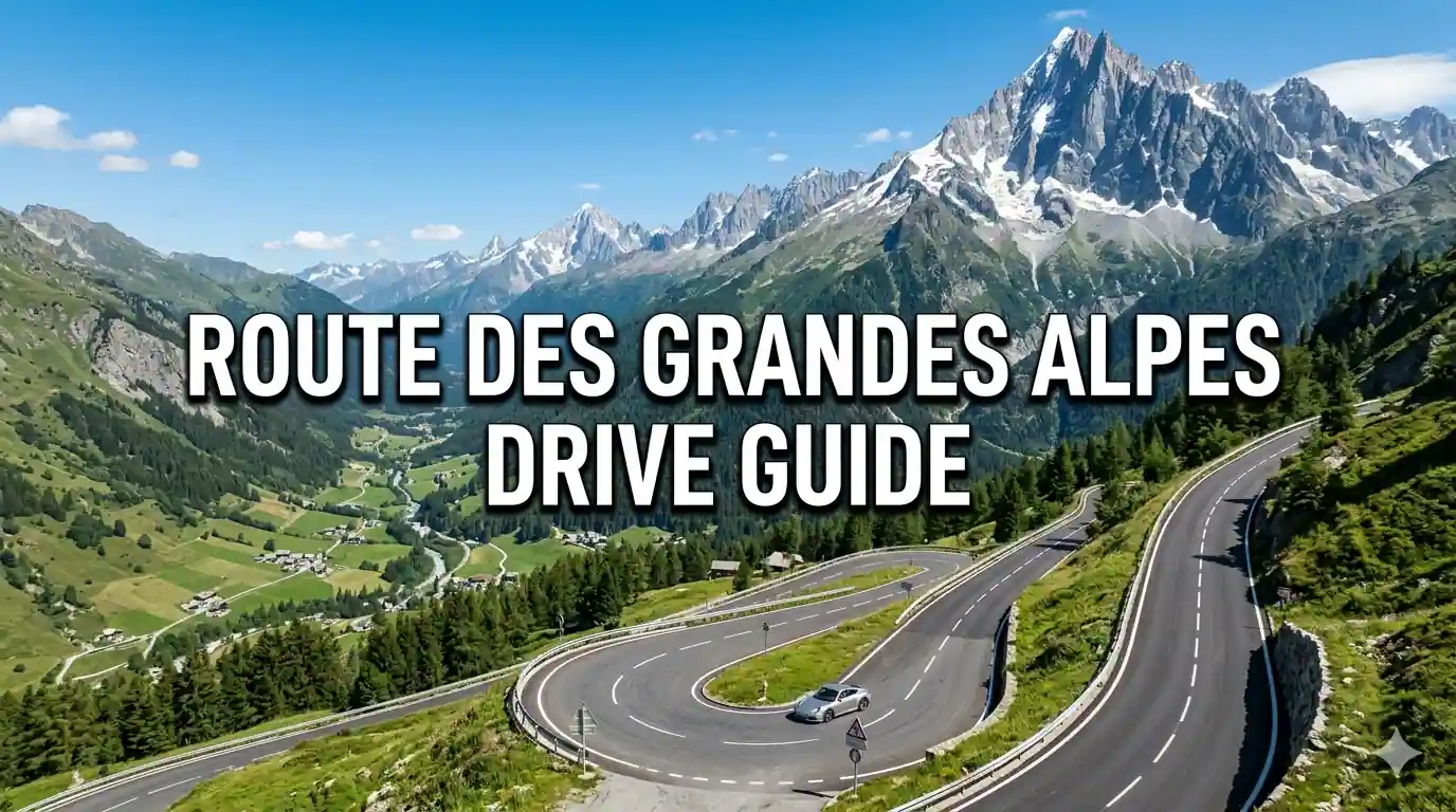
The Route des Grandes Alpes represents one of Europe's most spectacular driving experiences, traversing 720 kilometers of high mountain passes from Lake Geneva to the French Riviera. This legendary route connects 16 iconic Alpine cols including the Galibier, Izoard, and Bonette, offering unparalleled views of glaciers, alpine meadows, and dramatic rock formations. Most drivers complete the journey in 5 to 7 days, allowing time for scenic stops, village exploration, and photography at elevated viewpoints. This comprehensive guide provides everything needed to plan your inaugural Alpine road trip, from vehicle selection and seasonal timing to stage-by-stage itineraries and accommodation recommendations.
The primary user intent centers on understanding route logistics, vehicle requirements, optimal timing, and realistic cost expectations for this mountain driving adventure. You need verified pricing in USD, exact distances between stops, pass elevation data, booking procedures for mountain accommodations, and practical tips for navigating high-altitude roads without prior Alpine driving experience. This guide delivers detailed, actionable information based on current road conditions and official tourism data.
Average drivers report that the Route des Grandes Alpes exceeds expectations for scenic beauty, road quality, and cultural immersion. The route balances challenging driving with accessible infrastructure, featuring well-maintained asphalt, regular fuel stops, and charming mountain villages offering authentic Savoyard cuisine. Most travelers allocate USD 180 to 350 daily for vehicle rental, fuel, accommodation, and meals, excluding international flights. The combination of dramatic landscapes, engineering marvels, and cultural richness makes this route ideal for inaugural European road trip experiences.
Essential Route des Grandes Alpes Travel Data
| Total Route Distance | 720 kilometers from Lake Geneva to Nice |
| Number of Major Passes | 16 cols exceeding 2000 meters elevation |
| Maximum Elevation | 2802 meters at Col de la Bonette |
| Recommended Duration | 5 to 7 days for comfortable pacing |
| Best Driving Season | June to September for open passes |
| Average Daily Cost | USD 180 to 350 per person |
| Vehicle Recommendation | Compact car with manual transmission |
Why the Route des Grandes Alpes Ranks Among Europe's Greatest Drives

The Route des Grandes Alpes earns its legendary status through an unparalleled combination of engineering achievement, natural beauty, and cultural richness. Conceived in 1911 and fully completed in 1937, this route represents one of the earliest organized scenic drives in Europe, designed specifically to showcase the French Alps' most dramatic landscapes. Unlike modern highways that tunnel through mountains, this route climbs over historic passes used for centuries by traders, pilgrims, and military forces, preserving the authentic mountain travel experience.
Geographic diversity distinguishes this route from other European scenic drives. You traverse multiple climate zones within a single day, moving from the temperate shores of Lake Geneva through subalpine forests, alpine meadows above the tree line, and finally to Mediterranean vegetation near Nice. Elevation changes exceed 2,500 meters, creating dramatic temperature variations and constantly shifting perspectives. Each pass offers unique geological features, from the lunar landscapes of Col d'Izoard to the glacier views at Col du Galibier.
Cultural immersion enhances the driving experience significantly. The route connects traditional Savoyard villages where stone chalets, wooden balconies, and church spires create postcard-perfect scenes. You encounter local markets selling Reblochon cheese, diot sausages, and tarte aux myrtilles, experiencing regional cuisine at its source. Mountain refuges and family-run hotels provide authentic hospitality, often with multilingual staff accustomed to international travelers. This cultural layer transforms a scenic drive into a meaningful journey through Alpine heritage.
Driving dynamics prove engaging without being intimidating for prepared motorists. The route features well-maintained asphalt, clear signage in French and English, and regular pullouts for photography and rest. Hairpin turns, elevation changes, and narrow sections require attention but reward careful driving with unparalleled views. Unlike some Alpine routes that cater primarily to cyclists or motorcyclists, this road accommodates standard passenger vehicles comfortably when driven responsibly.
Photographic opportunities abound at every elevation. Morning light illuminates eastern-facing slopes with golden warmth, while afternoon sun creates dramatic shadows on western exposures. Wildflowers bloom in alpine meadows during July and August, adding vibrant color to rocky landscapes. You capture glacier panoramas, waterfall cascades, and village vistas from elevated viewpoints accessible directly from the roadside. The route's design prioritizes scenic appreciation, with pullouts strategically positioned at the most photogenic locations.
How to Reach the Route Starting Point at Lake Geneva

The Route des Grandes Alpes officially begins in Thonon-les-Bains or Évian-les-Bains on the southern shore of Lake Geneva, approximately 60 kilometers east of Geneva, Switzerland. Multiple transportation options connect major international hubs to this starting point, each with distinct advantages depending on your origin, budget, and preference for flexibility.
Flight Options and Airport Transfers
Geneva International Airport serves as the most convenient international gateway, located just 60 kilometers from Thonon-les-Bains. Direct flights connect Geneva to major cities including New York, London, Paris, Frankfurt, and Amsterdam, with round-trip economy fares ranging from USD 500 to 1,200 depending on departure city and booking timing. Ground transportation from Geneva Airport to the route start takes 45 to 75 minutes via rental car, taxi, or pre-booked shuttle.
Travelers from the United States typically connect through major European hubs before reaching Geneva. Total journey times range from 10 to 16 hours including connections. Booking flights 8 to 12 weeks in advance secures optimal pricing, particularly for summer travel when demand peaks. United Kingdom travelers benefit from numerous direct flights lasting approximately 2 hours, with fares between USD 100 and 350.
Alternative airports include Lyon-Saint Exupéry (180 kilometers from Thonon) and Chambéry (120 kilometers), both offering seasonal connections from European cities. While these airports may provide lower airfares, ground transportation to the route start requires additional driving time of 1.5 to 2.5 hours. Evaluate total travel time and cost when selecting arrival airports.
Car Rental and Vehicle Selection
Car rental proves essential for the Route des Grandes Alpes, as public transportation cannot access high mountain passes. Major rental companies operate at Geneva Airport, with weekly rates ranging from USD 300 to 600 for compact vehicles. Manual transmission cars cost 20 to 30 percent less than automatics, though automatics prove worthwhile for drivers unfamiliar with mountain driving techniques.
Vehicle selection significantly impacts driving comfort and safety. Compact cars with 90 to 120 horsepower handle mountain roads efficiently while minimizing fuel consumption. All-wheel drive provides additional confidence on wet or gravel sections but proves unnecessary for summer driving on paved passes. Avoid large SUVs or luxury vehicles, as narrow village streets and tight hairpins create maneuvering challenges.
Insurance coverage requires careful consideration. Standard rental policies often exclude damage to undercarriage, tires, and windshields, which face increased risk on mountain roads. You should purchase comprehensive coverage including zero-deductible options for peace of mind. Verify that your policy covers driving on high-altitude passes, as some exclusions apply above specific elevations.
Alternative Transportation and One-Way Logistics
One-way car rentals enable starting at Lake Geneva and finishing in Nice without returning to the origin. Major rental companies offer this service for additional fees ranging from USD 100 to 300 depending on vehicle category and season. This option maximizes itinerary efficiency but requires advance booking, particularly for summer travel when demand peaks.
Train travel to the starting point provides an alternative for travelers preferring not to drive immediately upon arrival. Direct trains connect Geneva Airport to Thonon-les-Bains in 45 minutes, with fares around USD 15 to 25. However, reaching high passes requires vehicle access, making train travel practical only if combined with local car rental or organized tours for mountain segments.
Best Time to Drive the Route des Grandes Alpes

Seasonal timing critically impacts route accessibility, driving conditions, and overall experience quality. The high mountain passes that define this route close during winter months due to snow accumulation, creating a limited operational window that requires strategic planning.
Peak season spans July and August when all passes remain open, weather proves most reliable, and mountain infrastructure operates at full capacity. Temperatures at valley elevations average 20 to 28 degrees Celsius, while high passes experience cooler conditions of 10 to 18 degrees with potential afternoon thunderstorms. Daylight extends until 9 PM, maximizing photography opportunities and driving time. However, these months bring peak tourist traffic, with popular viewpoints experiencing congestion and accommodations requiring booking 2 to 3 months in advance.
Shoulder seasons of June and September deliver optimal balance for most drivers. June features blooming wildflowers, flowing waterfalls from snowmelt, and fewer crowds, though some higher passes may open only in mid to late June. September offers stable weather, golden autumn colors at lower elevations, and reduced tourist density after school holidays conclude. Accommodation prices drop 20 to 40 percent compared to peak season, and you can often secure same-week reservations at desirable properties.
Early season attempts in late May prove risky due to unpredictable pass openings. Snow clearance operations depend on weather conditions, with some passes remaining closed until mid-June. You must verify current road status daily through official sources before attempting high-elevation segments. Late season travel in October faces similar uncertainties as early snowfalls can close passes without extended warning.
Weather considerations require daily monitoring regardless of season. Mountain conditions change rapidly, with clear mornings potentially developing into afternoon thunderstorms. You should check forecasts at each overnight stop and adjust driving plans accordingly. Carrying appropriate clothing for temperature variations from valley to summit proves essential for comfort and safety.
Complete Cost Breakdown and Budget Planning

Driving the Route des Grandes Alpes accommodates various budget levels through strategic choices in vehicle selection, accommodation, dining, and pacing. Understanding all cost components enables realistic planning and prevents unexpected expenses during this mountain adventure.
Budget travelers spending USD 120 to 200 per day utilize economy car rentals, budget accommodations, and self-catering meals. Compact car rentals cost USD 40 to 60 daily, while budget hotels or guesthouses charge USD 60 to 90 per night. You purchase groceries from village markets for USD 20 to 35 daily, preparing simple meals or picnics. This approach requires planning but delivers authentic experiences without premium pricing. Fuel costs average USD 1.80 to 2.10 per liter in France, totaling USD 120 to 180 for the complete route.
Mid-range budgets of USD 220 to 380 per person per day enable comfortable vehicle rentals, quality accommodations, restaurant dining, and guided experiences. Mid-size car rentals cost USD 60 to 90 daily, while charming mountain hotels or B&Bs charge USD 100 to 160 per night. Restaurant lunches and dinners range from USD 35 to 65 per person. This tier represents the sweet spot for most travelers seeking comfort without extravagance while experiencing the route's highlights fully.
Premium experiences costing USD 450 to 750 per person per day include luxury vehicle rentals, four-star mountain hotels, gourmet dining, and private guided tours. Premium car rentals with advanced features cost USD 120 to 200 daily. Luxury hotels with spa facilities and mountain views charge USD 250 to 450 per night. Michelin-recognized restaurants add USD 80 to 150 per person for multi-course meals. This tier suits special occasions or travelers prioritizing exceptional service and unique access.
| Expense Category | Budget Option | Mid Range | Premium |
| Car Rental Per Day | USD 40 to 60 | USD 60 to 90 | USD 120 to 200 |
| Accommodation Per Night | USD 60 to 90 | USD 100 to 160 | USD 250 to 450 |
| Daily Food and Drinks | USD 20 to 35 | USD 35 to 65 | USD 80 to 150 |
| Fuel for Complete Route | USD 120 to 180 | USD 120 to 180 | USD 150 to 220 |
| Travel Insurance Coverage | USD 45 to 75 | USD 75 to 120 | USD 120 to 200 |
| Optional Guided Tours | N/A | USD 60 to 120 | USD 200 to 400 |
Stage by Stage Route Breakdown

The Route des Grandes Alpes divides naturally into manageable daily segments, each featuring distinct landscapes, cultural highlights, and driving characteristics. This stage-by-stage breakdown enables strategic planning while allowing flexibility for personal interests and pacing preferences.
Stage 1: Lake Geneva to Megève via Col des Aravis
Your journey begins in Thonon-les-Bains or Évian-les-Bains on Lake Geneva's southern shore. The initial 60 kilometers follow gentle lakeside roads before ascending toward the first major pass. Col des Aravis (1,487 meters) introduces Alpine driving dynamics with moderate hairpins and panoramic views of the Aravis mountain range. This stage covers 95 kilometers with 2.5 to 3.5 hours of driving time excluding stops.
Megève serves as an elegant mountain resort town offering upscale shopping, gourmet dining, and luxury accommodations. The village center preserves traditional Savoyard architecture with wooden chalets and cobblestone streets. You can explore on foot after parking, as the compact center proves walkable. Accommodation options range from budget guesthouses to five-star hotels, with advance booking recommended during peak season.
Stage 2: Megève to Bourg-Saint-Maurice via Cormet de Roselend
This stage traverses dramatic high-altitude terrain featuring Cormet de Roselend (1,968 meters) and approaches the spectacular Lac de Roselend reservoir. The 110-kilometer route requires 3 to 4 hours of driving, with numerous pullouts for photography of turquoise waters and granite peaks. Road conditions remain excellent, though narrow sections require careful navigation around oncoming traffic.
Bourg-Saint-Maurice provides practical amenities including fuel stations, supermarkets, and diverse accommodation options. The town serves as a gateway to Les Arcs ski resort in winter and hiking trails in summer. Evening exploration reveals traditional Savoyard restaurants serving fondue, raclette, and local wines. You should reserve dinner accommodations during peak season due to limited capacity in mountain towns.
Stage 3: Bourg-Saint-Maurice to Briançon via Col du Petit Saint Bernard and Col du Galibier
This challenging stage features two iconic passes, beginning with Col du Petit Saint Bernard (2,188 meters) on the Italian border before ascending to the legendary Col du Galibier (2,642 meters). The 140-kilometer route requires 4 to 5.5 hours of driving, with significant elevation changes and exposed sections demanding focused attention. Weather conditions critically impact safety, requiring flexible scheduling and contingency plans.
Col du Galibier ranks among cycling's most famous climbs and offers equally dramatic driving experiences. The summit features a monument to Tour de France history and panoramic views extending to Mont Blanc on clear days. Temperature drops significantly at elevation, requiring layered clothing even during summer months. Briançon, Europe's highest city at 1,326 meters, provides historic fortifications and UNESCO-listed architecture for evening exploration.
Stage 4: Briançon to Barcelonnette via Col d'Izoard
Col d'Izoard (2,360 meters) delivers one of the route's most surreal landscapes, featuring the Casse Déserte lunar-like rock formations at the summit. The 105-kilometer stage requires 3 to 4 hours of driving, with the Izoard segment offering minimal tree cover and maximum exposure to mountain weather. This pass frequently appears in Tour de France broadcasts and rewards drivers with unforgettable vistas.
Barcelonnette sits in the sunny Ubaye Valley, offering a more Mediterranean atmosphere as you approach the route's southern terminus. The town features Mexican-influenced architecture reflecting 19th-century emigration patterns. Accommodation options prove more affordable than northern Alpine resorts, with many properties offering valley views and outdoor terraces. Evening strolls along the Ubaye River provide relaxing conclusion to a demanding driving day.
Stage 5: Barcelonnette to Nice via Col de la Bonette
The final stage culminates at Col de la Bonette (2,802 meters), the route's highest point and one of Europe's highest paved roads. The 170-kilometer journey requires 4.5 to 6 hours of driving, transitioning from high Alpine terrain to Mediterranean coastline. The Bonette summit features a circular road offering 360-degree views and a small chapel marking the elevation milestone.
Descending from the Bonette, you pass through the Mercantour National Park before reaching the Mediterranean coast near Nice. The landscape transforms dramatically, with alpine vegetation giving way to olive groves, vineyards, and coastal vegetation. Nice provides international airport connections, diverse accommodation options, and urban amenities for post-drive relaxation. You can extend your journey along the French Riviera or conclude your Alpine adventure in this vibrant coastal city.
Vehicle Requirements and Driving Preparation

Successful Route des Grandes Alpes travel requires appropriate vehicle selection and thorough preparation for mountain driving conditions. Understanding technical requirements and safety protocols prevents mechanical issues and enhances confidence on challenging roads.
Engine performance proves critical for high-altitude driving. Vehicles with 90 to 120 horsepower handle mountain ascents efficiently without excessive strain. Turbocharged engines maintain power at elevation where naturally aspirated engines lose performance. You should avoid underpowered vehicles that struggle on steep grades, as prolonged high-RPM operation increases mechanical stress and fuel consumption.
Brake systems require particular attention for extended descents. Mountain routes feature continuous downhill sections where brake fade poses safety risks. You should utilize engine braking by selecting lower gears rather than riding brakes continuously. Modern vehicles with hill descent control provide additional assistance, but driver technique remains paramount. Inspect brake pads and fluid before departure, and allow cooling periods during extended descents.
Tire condition directly impacts safety on mountain roads. You should verify tread depth exceeds legal minimums and check pressure when tires are cold. All-season tires prove adequate for summer driving on paved passes, though dedicated summer tires offer superior grip on dry mountain asphalt. Carry a spare tire or tire repair kit, as roadside assistance proves limited in remote mountain areas.
Navigation tools combine digital and analog approaches for reliability. Smartphone maps with offline downloads provide real-time guidance, but paper maps serve as essential backups when cellular coverage fails. You should download route segments before entering mountain areas and carry a physical road atlas of the French Alps. GPS devices designed for European travel offer additional reliability for international drivers.
Accommodation Booking Strategies and Mountain Lodging

Securing appropriate accommodation along the Route des Grandes Alpes requires advance planning and understanding of mountain lodging characteristics. Limited capacity in small villages and seasonal demand create booking challenges that benefit from strategic approaches.
Booking windows vary significantly by season and location. Peak season accommodations in popular villages like Megève, Chamonix, or Briançon require reservation 2 to 3 months in advance. Shoulder season properties may accommodate bookings 2 to 4 weeks ahead. You should secure at least the first two nights before departure, then book subsequent nights based on daily progress and weather conditions.
Accommodation types range from budget guesthouses to luxury mountain hotels, each offering distinct advantages. Family-run chambres d'hôtes provide authentic hospitality, local knowledge, and home-cooked meals at moderate prices. Mountain hotels offer amenities like spas, restaurants, and concierge services at premium rates. You should verify parking availability when booking, as village centers often feature limited or paid parking facilities.
Altitude considerations impact comfort and health for some travelers. Properties above 1,500 meters may cause mild altitude effects including headache or sleep disruption for sensitive individuals. You can mitigate these effects by ascending gradually, staying hydrated, and avoiding excessive alcohol consumption during initial high-altitude nights. Most travelers adapt within 24 to 48 hours without significant issues.
Meal arrangements require planning in remote mountain areas. Many small hotels offer half-board options including dinner and breakfast, simplifying dining logistics after long driving days. You should confirm dinner service times when booking, as mountain restaurants often serve earlier than urban establishments. Vegetarian or special dietary requests should be communicated in advance due to limited menu flexibility in remote locations.
Safety Considerations and Mountain Driving Protocols

Mountain driving on the Route des Grandes Alpes presents genuine hazards requiring respect, preparation, and adaptive decision-making. Understanding safety protocols and emergency procedures ensures enjoyable experiences while minimizing risks.
Weather monitoring proves essential for safe mountain travel. Conditions change rapidly at elevation, with clear mornings potentially developing into afternoon thunderstorms, fog, or even snow at high passes. You should check forecasts at each overnight stop using reliable sources like Météo-France or official road condition websites. Flexible scheduling allows delaying departures or altering routes when weather threatens safety.
Driving techniques specific to mountain roads enhance safety and vehicle longevity. You should maintain moderate speeds appropriate for conditions rather than posted limits, particularly on hairpin turns and narrow sections. Use lower gears for descents to control speed without excessive brake application. Yield to uphill traffic on narrow sections, as ascending vehicles require momentum. Allow faster vehicles to pass at designated pullouts rather than creating dangerous following situations.
Emergency preparedness requires carrying essential equipment and knowledge. You should maintain a basic emergency kit including first aid supplies, warm clothing, water, snacks, flashlight, and mobile phone charger. Mountain rescue services respond to 112 or 18 for emergencies, but response times prove lengthy in remote areas. Travel insurance covering medical evacuation and vehicle assistance provides valuable protection for international travelers.
Wildlife encounters require caution, particularly at dawn and dusk when animals cross roads. You should reduce speed in forested areas and remain alert for deer, chamois, or marmots. Collisions with large animals cause significant vehicle damage and potential injury. If you encounter wildlife, slow gradually without sudden braking that could cause loss of control on mountain roads.
0 Comments